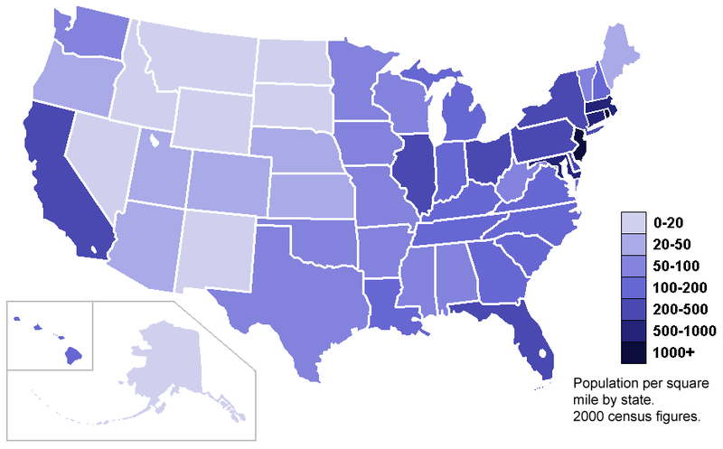
Source and direct link to map: http://upload.wikimedia.org/wikipedia/commons/thumb/7/78/USA_states_population_density_map.PNG/800px-USA_states_population_density_map.PNG
Standardized choropleth maps are maps where the data is areally averaged. Areally averaged data can be presented in many different ways such as densities or percentages. This map is a standardized choropleth map that illustrates population density of the United States. This map is based on the 2000 Census.

No comments:
Post a Comment