Direct link to map: http://www.reedhome.org.uk/Documents/OSMCover.png
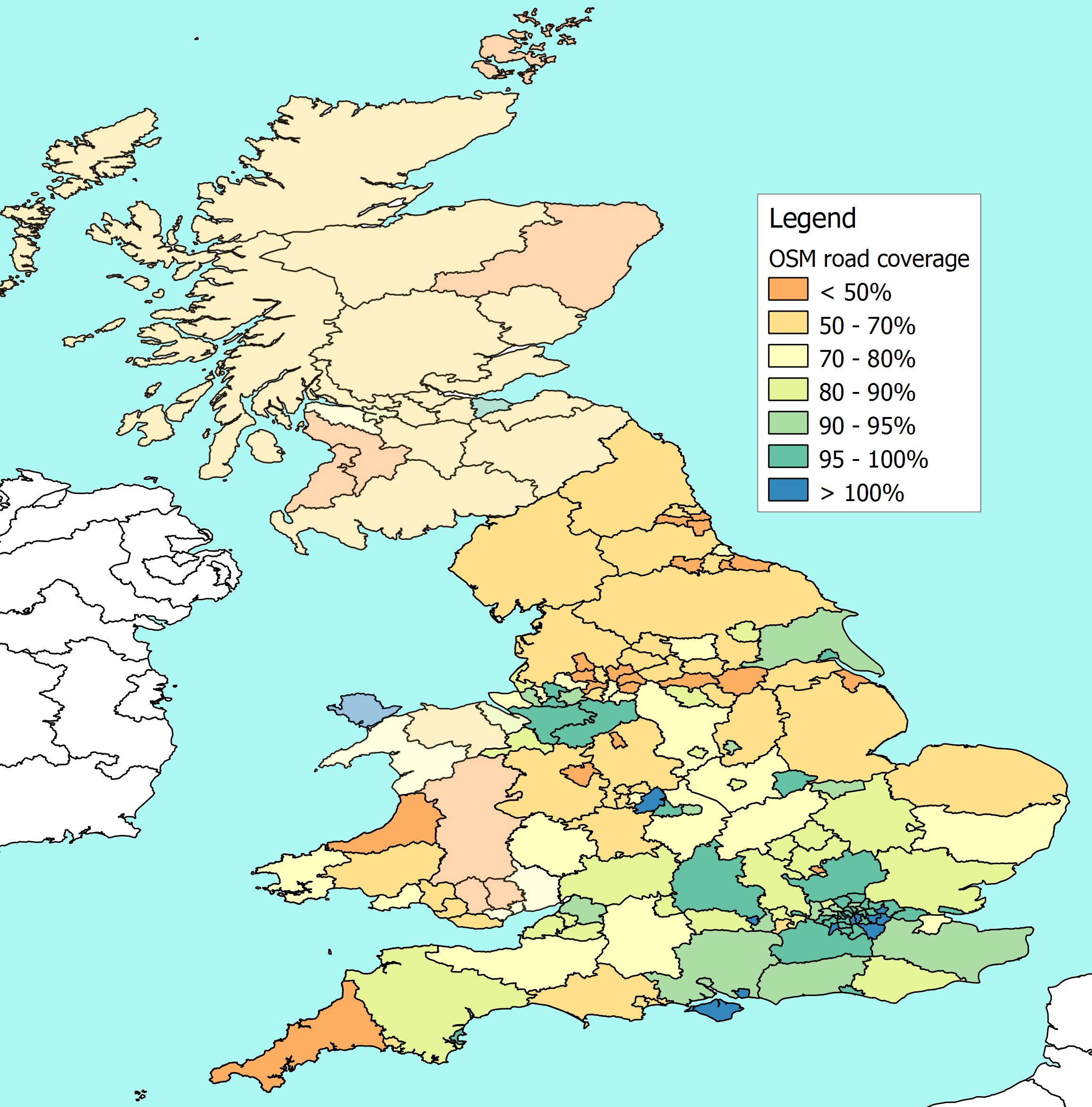
Choropleth maps display different statistical values for a variable in different colors or patterns. This map compares the Department of Transport measured road lengths by English county, and comparing them with the total lengths of roads in OpenStreetMap.
No comments:
Post a Comment