Direct link to map: http://upload.wikimedia.org/wikipedia/commons/8/8e/1815_tambora_explosion_B.png
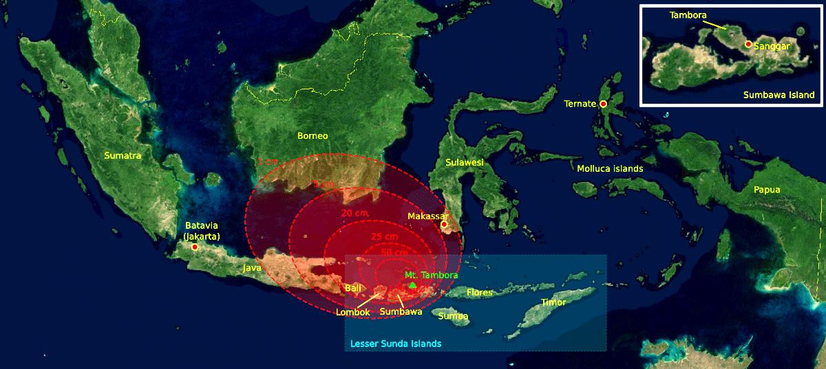
A isopach map is a map of the areal extent and thickness variation of a stratigraphic unit. They are used in geological exploration for oil and for underground structural analysis. This map is an illustration of the 1815 Mount Tambora eruption. The red areas are maps of the thickness of volcanic ashfall.
No comments:
Post a Comment